Description
The Master Plan for North County Courthouse Campus addresses four parcels of approximately 9.7 acres, located in the City of South San Francisco, San Mateo County. The campus houses the publicly held parcels for the North County Courthouse Building, the Probation Department Building, the North […]
Description
Three unique sites have been identified by the City and County of Honolulu to evaluate for housing development in accommodating anticipated population growth. Together with Strategic Economics and PBR Hawaii, VMWP is conducting test fits tailored to each site that correlate with housing market analysis, […]
DESCRIPTION
California College of the Arts (CCA) is one of the Bay Area’s premier arts institutions with its main campus located at the terminus of College Avenue in Oakland’s vibrant Rockridge neighborhood. To increase efficiency and manage future expansion, CCA is considering the consolidation of all their facilities and […]
description
VMWP is creating a framework or strategy plan for the City of South San Francisco that maps existing and potential opportunity sites, streetscape development projects, and public realm improvements throughout the Downtown district. This framework plan will create a blueprint for the City to follow […]
Description
Located south of Downtown Minneapolis, this infill building site fronts Minnehaha Regional Park and occupies a prominent corner neighborhood gateway. Its location near the Metro Light Rail and proximity to the airport make this site valuable for developing higher-density housing in the neighborhood. Together with Lander […]
DESCRIPTION
VMWP is the urban design and architectural consultant for the Environmental Protection Agency’s Smart Growth Technical Assistance Program Team. The EPA Technical Assistance Program provides grants in the form of technical assistance from economic urban design and traffic and circulation specialists to communities faced with […]
description
The Ferry/Gateway District Plan for the City of Bainbridge Island, Washington focuses on a 10 acre site adjacent to a high capacity car ferry terminal, 40 minutes from downtown Seattle. VMWP is coordinating with the community, property owners and Washington State Ferries to create a […]
Description
VMWP is providing urban design leadership for the development visioning to transform two mid-century Sacramento housing projects into a mixed-income multi-generational community.
VMWP, working with Mogavero Notestine Associates and the Related Companies with the Sacramento Housing and Redevelopment Agency, supported an extensive community outreach process to […]
DESCRIPTION
The Leland Avenue Streetscape project redesigns the “main street” of San Francisco’s Visitacion Valley into a vibrant green street. Leland Avenue is San Francisco’s first streetscape redesign as part of their Better Streets program. The Leland Avenue project will design street improvements to enhance the […]
DESCRIPTION
The plan, developed through an inclusive community design process, will be a tool to assist the City of Santa Rosa and the Community to identify those key Capital Improvement Projects (CIPs) in the Courthouse Square Area which will maintain Downtown as the major regional office, […]
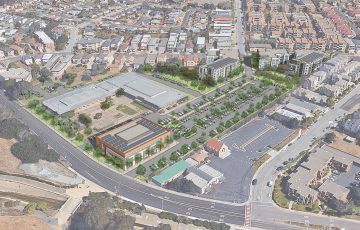 North County Courthouse
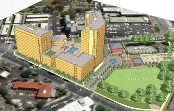 Housing Development Feasibility Evaluations
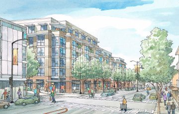 California College of the Arts Oakland Campus
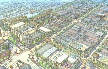 SSF Downtown Strategy Plan
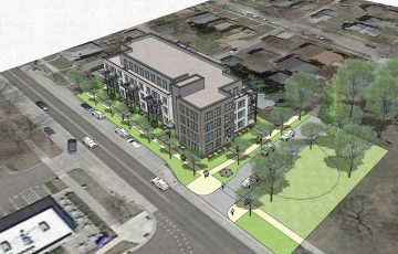 Minnehaha Capacity Study
 EPA Smart Growth Charettes
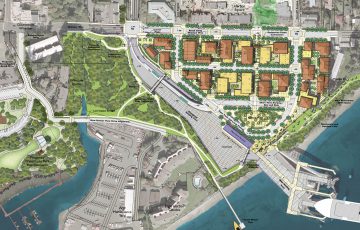 Bainbridge Ferry/ Gateway District Plan
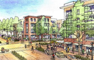 Marina Vista / Alder Grove Master Plan
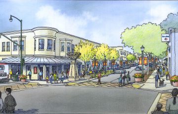 Leland Avenue Streetscape Design
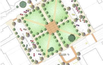 Courthouse Square and Transit Mall